The Sweet Track and Climate Change
 Richard Brunning
Investigating the vulnerability of the UK’s oldest wooden trackway.
This project commissioned by Historic England from South West Heritage Trust examined the condition of one of our oldest Neolithic monuments and assessed its vulnerability to future climate change.
The Sweet Track
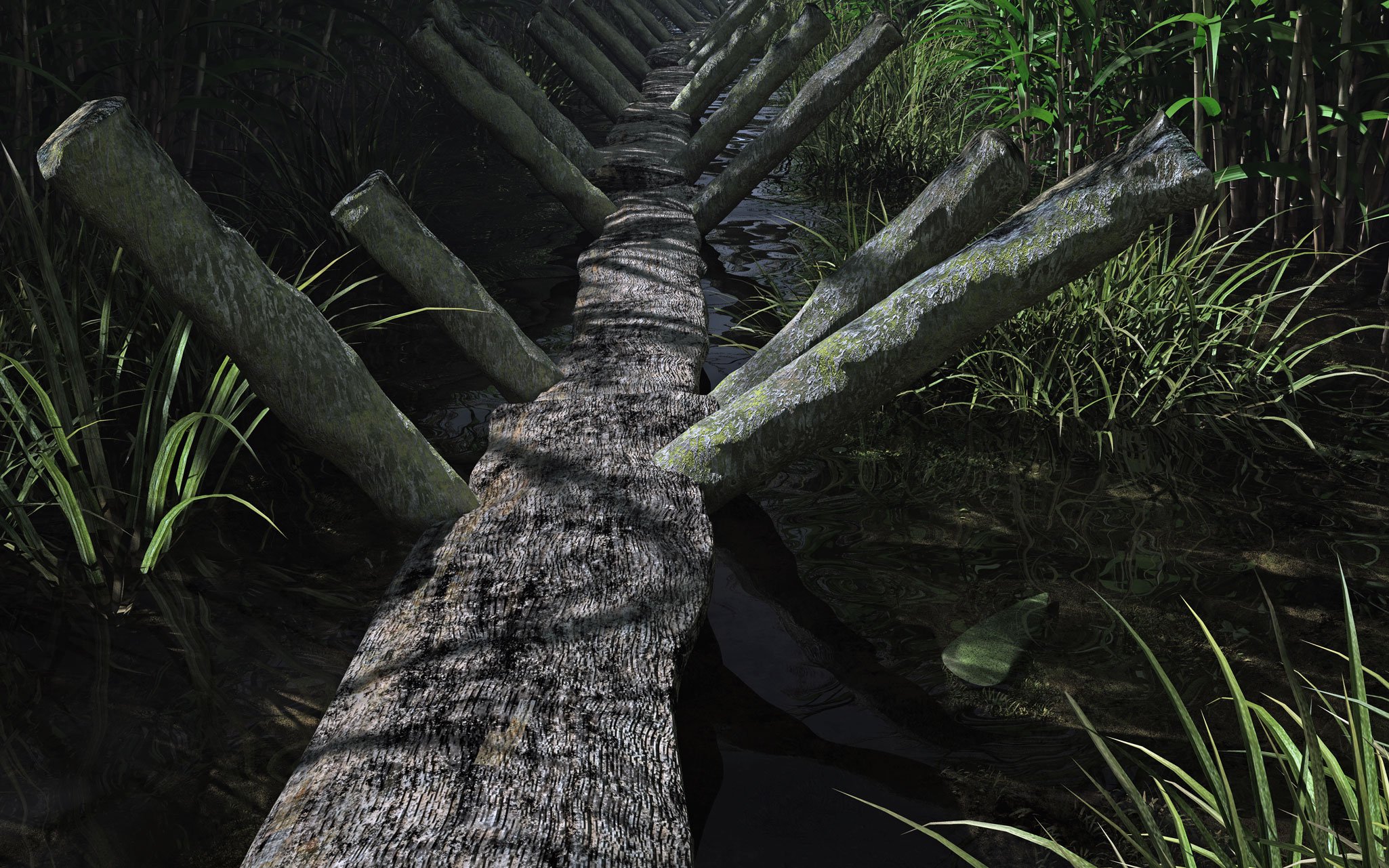
The Sweet Track is a very early Neolithic wooden trackway, built as a single plank raised walkway across almost 2 kilometres of reedswamp, between the Polden hills and the island of Westhay, in the Brue valley west of Glastonbury, Somerset. It is named after Ray Sweet, the peat digger who discovered it in 1973.
A wide range of Neolithic material culture was deposited beside the trackway, including polished stone and flint axes, flint arrowheads, fine pottery and a range of organic objects including a wooden bowl, a toy axe, yew pins, a possible bow, a stirrer, and a digging stick. The presence of high-quality burnished pottery and a polished jadeite axe from the Alps with no handle, suggest that deliberate votive deposition of objects was taking place beside the trackway. The Sweet Track is the earliest structure in the UK associated with such ritual offerings.

The trackway has been dated by dendrochronological analysis of the well-preserved oak and ash planks used in its construction, several which have their last growth rings present enabling precise dating to the season felled.This proved that wood was felled for its construction in the winter of 3807/6BC or early spring 3806, with repairs taking place to at least 3800 BC (Hillam et al 1990). A lifespan of 9–12 years has been proposed for the structure (Coles and Brunning 2009).
Wrapping up
One section of the Sweet Track, in Shapwick Heath National Nature Reserve, was thought to be at particular risk of drying out because it doesn’t benefit from the pumping system that protects the structure elsewhere on the reserve by maintaining a high water table. It was therefore decided to trial a wrapping technique that had proved successful in protecting wetland sites in the Netherlands.
Over a 50 metre stretch of trackway, trenches were dug parallel to and across the line of the track, outlining two rectangular boxes 25 metres by 8 metres and the topsoil was removed from the interior of each box.
An impermeable membrane was then inserted into the trenches and wrapped over the interior of each box, leaving a narrow gap in the middle to allow rainfall to penetrate downwards.
In one box, the trenches were 3 metres deep allowing the membrane to connect to clay layers under the peat which contained the trackway. In the other box the membrane was taken to a shallower depth, 1 metre below the trackway level.
The trenches were backfilled and the topsoil replaced.
Unexpected discoveries
Where the trenches crossed the line of the trackway the opportunity was taken to investigate the character of the structure, plot its position and assess its condition. The character and depth below ground of the track varied over the area, because the Neolithic environment it went through, changed from a reedswamp to a wet woodland as it approached a natural island of hard geology at the southern end.


The trench in the reedswamp revealed the classic raised walkway structure, known from previous excavations, but in the wet woodland the structure was much less substantial and showed more evidence of recent decay as it was less deeply buried in the peat as it climbed the edge of the island.
One surprise came in the reedswamp trench, where a collection of wood was encountered 40 centimetres above the Sweet Track, but seemingly following the same orientation, with other cut pieces just to one side.
Radiocarbon dating showed that this activity probably took place 500-700 years after the Sweet Track had gone out of use. It’s impossible to know if this is purely coincidental or if the line of the earlier monument was memorialised somehow on the island.
Disappointment and hope
Extensive monitoring of the burial environment by York Archaeological Trust and the National Museum of Denmark showed that the membrane had no significant effect on the burial environment and neither method of its insertion at different depths managed to help retain moisture in the peat over summer months.
The three years of monitoring did, however, allow analysis under different climatic conditions, with a wet summer in 2017 followed by an especially dry one in 2018. Throughout the monitoring there was no significant threat to the monument from desiccation, even in the dry summer of 2018.
Anoxic conditions (ie with no oxygen) were maintained at the level of the trackway in all the years. This shows that, although the site doesn’t benefit from the dedicated pumping system that exists further north in the nature reserve, both the generally high water table generated by the reserve management and the presence of a large nearby reedbed appear to create a fairly high water table even in a very dry summer.
A new hope
The experiment showed that the Dutch wrapping method, though effective in some circumstances, did not provide any particular protection to the trackway in this location.
However, the monitoring results showed that the high local water table created by the nature reserve management appears to provide good protection from desiccation, even in the hotter, drier summers that are predicted to become more frequent, and more extreme, in the decades ahead.
The excavations, despite their small size, revealed useful information about the variable character of the trackway as it traversed different wetland habitats.
The unexpected discovery of later human activity on the same line as the Sweet Track raised new questions over the possible memorialisation of the earlier structure

Further information
Brunning, R 2022. Sweet Track site (area SWB), Brue Valley, Somerset. Historic England Research Report 5/2022
Coles, B and Brunning, R 2009. 'Following the Sweet Track'. In G. Cooney, K Becker, J Coles, M Ryan and S Sievers (eds). Relics of Old Decency: Archaeological Studies in Later Prehistory, 25-37. Wordwell. Dublin
Heritage South West Youtube video Digital recreation of the Sweet Track in its Neolithic landscape
Hillam, J, Groves, CM, Brown, DM, Baillie, MGL, Coles, JM and Coles, BJ 1990 'Dendrochronology of the English Neolithic'. Antiquity 64, 210-219.


