Current Aerial Investigation Projects
 Simon Crutchley
Here you can find an overview of research projects currently being carried out by our aerial investigation team.
The project will build on work started by the previously commissioned Dorset Lower Stour River Catchment Aerial Investigation and Mapping project, which demonstrated the wealth of archaeological sites within the Stour River catchment, particularly concentrated on Cranborne Chase.

The aerial survey will map and record new and known sites in the north part of Buckinghamshire, where large-scale strategic housing allocation has been proposed, along with significant transport infrastructure upgrades and environmental threats.

The project will contribute information derived from aerial sources to the Wendling Beck Exemplar Partnership, a landscape-scale nature restoration project delivering natural capital improvement, ecological enhancement and investment in ecosystem.

This project uses aerial images to investigate and record the landscapes around Scunthorpe: prehistoric and Roman settlements, medieval villages and priories, the process of land improvement known as warping, ironstone mining and steel making.

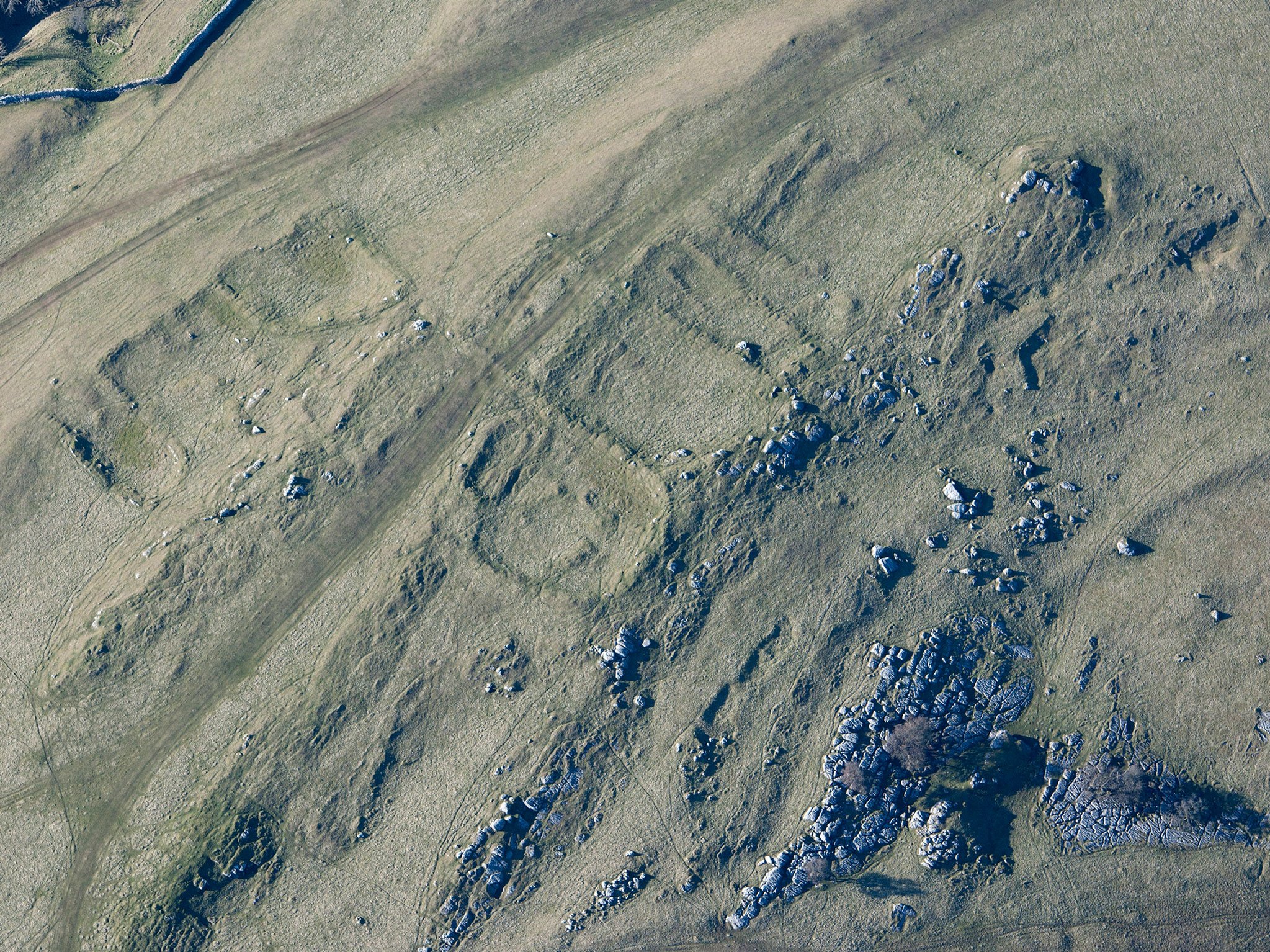
This well-preserved archaeological landscape with later prehistoric, Romano-British, medieval and post medieval remains is facing new challenges due to changes in farming practice, the national response to mitigating climate change and visitor recreation.

The Thanet Landscape Mapping Project takes as its starting point the exceptional significance of the Isle of Thanet, recording the distinctive archaeological heritage of this gateway region that provides a link between England and continental Europe.

Results of previous projects

Archaeological Investigation
-
Email
[email protected]
-
Address
EC4R 2YA


