Hoo Peninsula Historic Landscape Project
This page introduces the Hoo Peninsula Historic Landscape Project, a landscape in North Kent full of archaeology and buildings which reflect the area’s industrial, military and agricultural past.
Reports from this project currently available to download are listed here, a Historic England book on the Hoo Peninsula was published in 2015.
The Hoo Peninsula, located on the north Kent coast 30 miles east of central London, extends into the Thames Estuary between Gravesend and Rochester.
The peninsula lies in the local authority areas of Medway and Gravesham and is bounded by the River Thames to the north and west and the River Medway to the east. It is home to just over 31,000 inhabitants with settlements varying in size from over 7000 residents to just a few hundred.

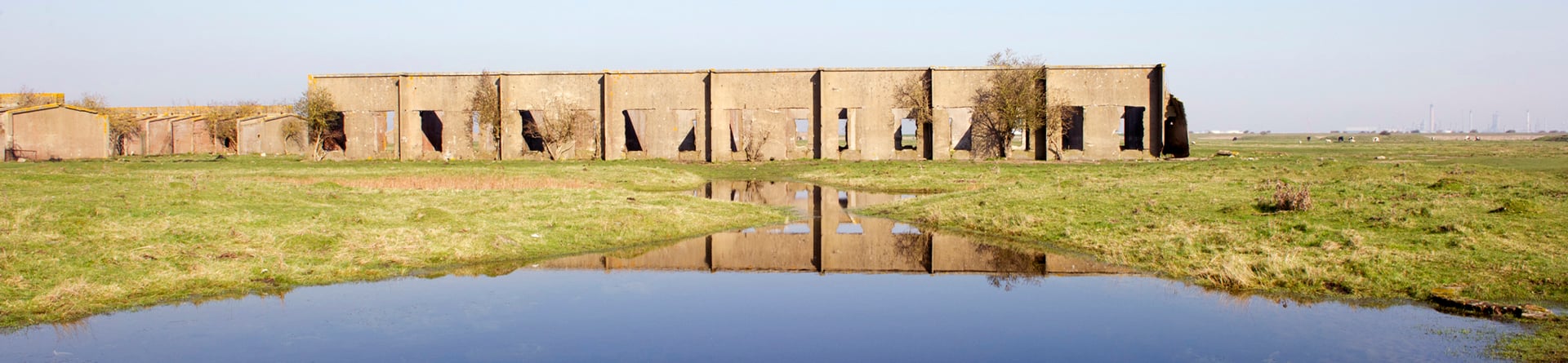
Between 2009 and 2012 English Heritage carried out the Hoo Peninsula Historic Landscape Project. The project aimed to increase knowledge and understanding of the historic environment of the Hoo Peninsula, capturing how its history and archaeology contributed to the character of the modern landscape, including the estuarine and marine environments.
Proximity to London and the Medway Towns has increased pressure on the peninsula’s land use, in the form of housing, economic and infrastructure developments.
Like all landscapes, it is also subject to environmental change. It is hoped that the project results will provide an improved basis for management and decision-making and enable the historic environment to fully inform the strategic decisions that will shape future change on the Hoo Peninsula in the coming decades.
We used a variety of approaches to analyse the peninsula’s landscape. These included:
- A palaeoenvironmental review
- Analysis, interpretation and mapping of the peninsula’s archaeological sites and landscapes that can be seen on aerial photographs
- Ground-based survey and analysis of key sites such as Cooling Radio Station and Cliffe Explosives Works
- A series of Outline Historic Area Assessments to investigate the peninsula’s buildings and villages, such as High Halstow.
- Historic Seascape, Farmstead and Landscape Characterisations, to capture how the character of the modern landscape, farmsteads and marine / estuarine environments reflect the area’s historic development
The main phase of the project is now complete and is summarised in a comprehensive report on the Hoo Peninsula, which brings together all the work carried out as part of the project. More detailed reports are listed below and are available to download.
We hope that our work will stimulate further research into - and enthusiasm for - the history and archaeology of the Hoo Peninsula, as well as inform debates about its changing landscape.
Informed Conservation book
This book on the Hoo Peninsula, published in 2015, is beautifully illustrated with photographs, maps, detailed plans and drawings. It considers the area’s rich heritage and the ways in which its fascinating past has shaped the landscape we see and value today.

Research Reports
Click on the name of the Research Report below to download:
Carpenter E (2014) Halstow Marshes, High Halstow, Hoo Peninsula, Kent: Halstow Marshes Decoy Pond. Historic England Research Report 17-2014
Carpenter E (2014) The London Stones: Marking the City of London’s Jurisdiction over the Thames and Medway. Historic England Research Report 16-2014
Carpenter et al (2013) Hoo Peninsula, Kent: Hoo Peninsula Historic Landscape Project. Historic England Research Report Series 21-2013
Clarke J and Smith J (2014) Hoo Peninsula Outline Historic Area Assessment: Cliffe and Cliffe Woods Parish. Historic England Research Report 2014-54
Clarke J and Smith J (2014) Hoo Peninsula Outline Historic Area Assessment: Cooling Parish. Historic England Research Report 2014-51
Clarke J and Smith J (2014) Hoo Peninsula Outline Historic Area Assessment: St Mary Hoo Parish. Historic England Research Report 2014-52
Edgeworth M (2013) Grain Island Firing Point, Yantlet Creek, Isle of Grain, Medway: Archaeological Desk-based Assessment. Historic England Research Report Series 39-2013
Gregory D and Newsome S (2010) Cooling Radio Station, Hoo Peninsula, Kent: An Archaeological Investigation of a Short-wave Receiving Station. Historic England Research Department Report Series 110-2010
Hazell Z (2011) Hoo Peninsula, North Kent Coast, Thames Estuary: A Palaeoenvironmental Review of the Development of the Peninsula. Historic England Research Department Report Series 14-2011
Newsome S amd Williams S (2011) Cliffe Fort, Hoo Peninsula, Kent: Survey and Anlaysis of the 19th-Century Coastal Artillery Fort . Historic England Research Report Series 15/2011
Newsome S and Pullen (2013) St Mary’s Marshes, Hoo St Mary, Medway, Kent: An assessment of the late 19th century explosives magazines. Historic England Research Report Series 52-2013
Pullen et al (2011) Curtis’s and Harvey Ltd Explosives Factory, Cliffe and Cliffe Woods, Medway: Archaeological Survey and Analysis of the Factory Remains. Historic England Research Department Report Series 11-2011
Small F (2014) Second World War Oil QF Bombing Decoy, Allhallows, Kent. Historic England Research Report 8-2014
Smith J (2014) Hoo Peninsula Outline Historic Area Assessment: Allhallows Parish. Historic England Research Report 11-2014
Smith J (2014) Isle of Grain, Hoo Peninsula, Kent. Historic Area Assessment. Historic England Research Report 1-2014
Smith J (2014) Hoo Peninsula Outline Historic Area Assessment: Stoke Parish. Historic England Research Report 12-2014
Smith J and Clarke J (2014) High Halstow, Hoo Peninsula, Kent: Historic Area Assessment. Historic England Research Report Series 53-2014
Truscoe K (2014) Hoo Peninsula Landscape Project: Second World War Stop Line: Hoo St Werburgh to Higham Marshes. Historic England Research Report 9-2014


